- 7740 Lonesome Pine Trail Greeneville TN 37743
- [email protected]
- 423-429-7778
General Soil Map
General Soil Map
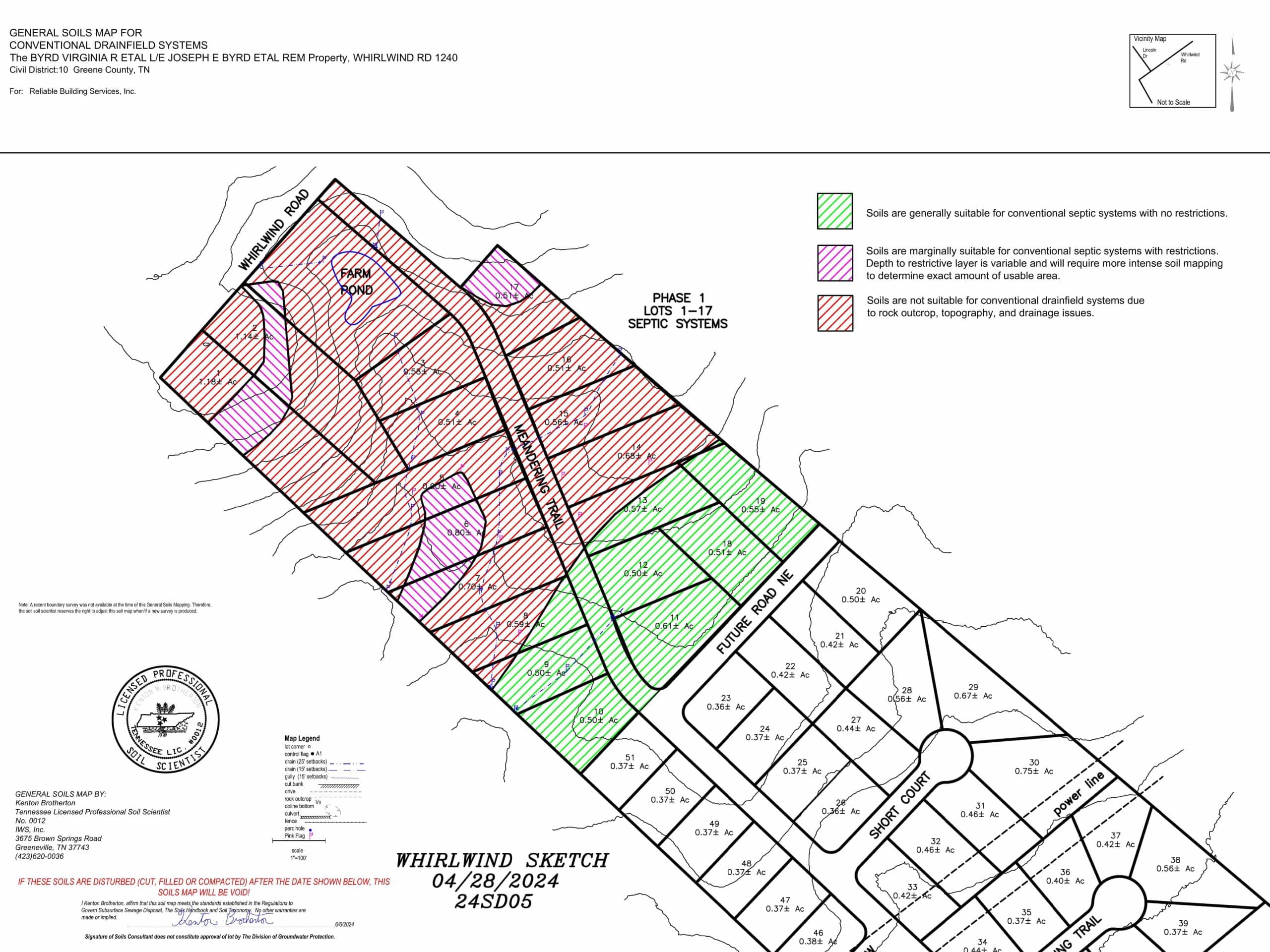
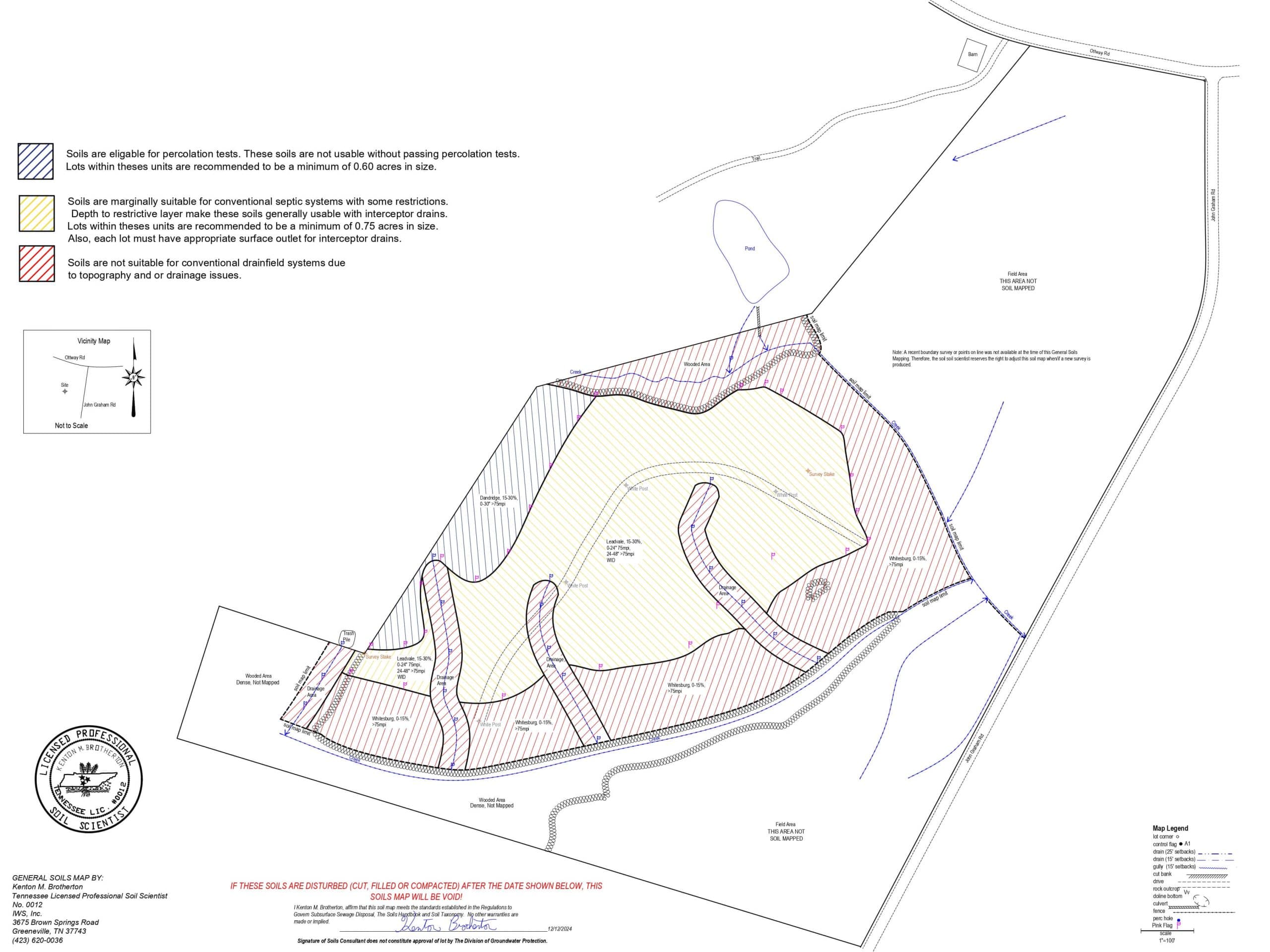
A general soil map is a map that shows the possibility of the site to support subsurface sewage disposal. This type of map is a general reconnaissance of the property in respect to subsurface sewage disposal. Typically, these maps are completed for a developer to determine if a property can be subdivided into multiple lots. This map will show the problem areas that may hinder development. Typically, a site visit is made and auger borings will be made sporadically through out the site. We will locate the major problems (i.e. rock, topography and drainage issues). Our deliverable will highlight the areas that are generally suitable and not suitable for conventional drainfield systems in accordance with TDEC’s Regulations to Govern Subsurface Sewage Disposal and the Soils Handbook. This map cannot be used for approval of a TDEC septic permit. It is merely a guide to determine what intensity of development that the said property can support.
Contact Us
Need one of our services?
From site planning to construction, IWS, Inc. is available and capable for all your development needs.