- 7740 Lonesome Pine Trail Greeneville TN 37743
- iwsonsite@gmail.com
- 423-429-7778
Extra-High Intensity Soil Map
Extra-High Intensity Soil Map
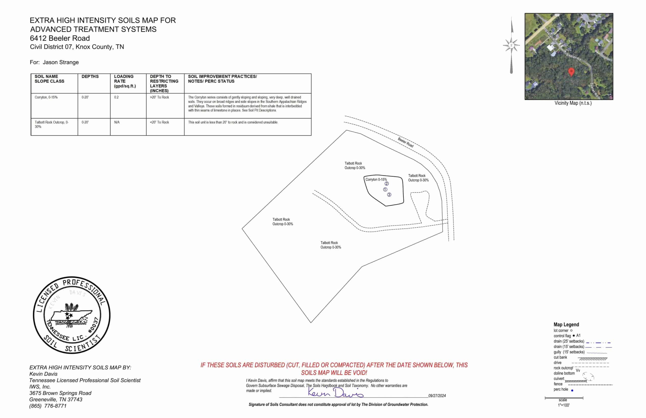
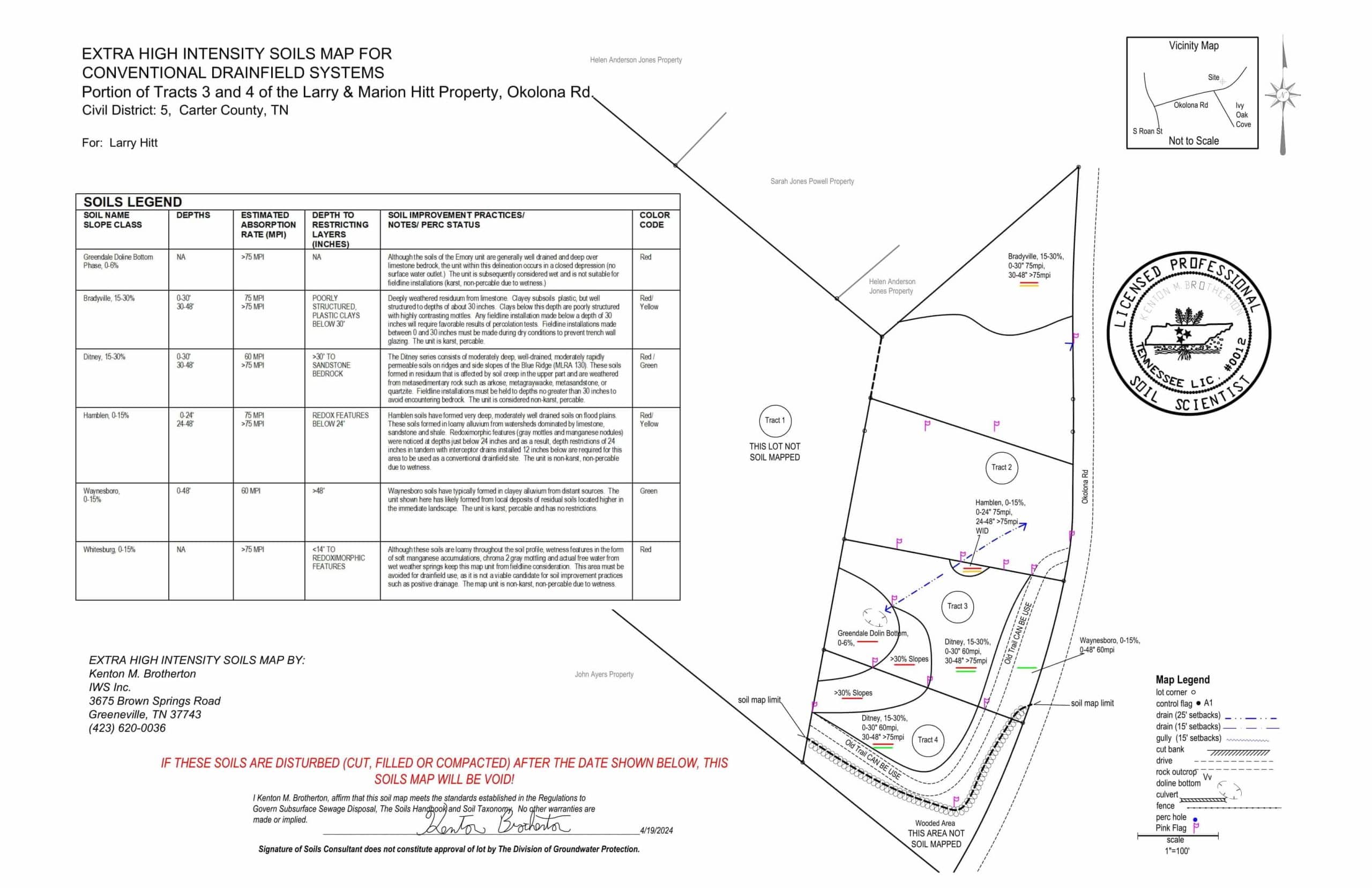
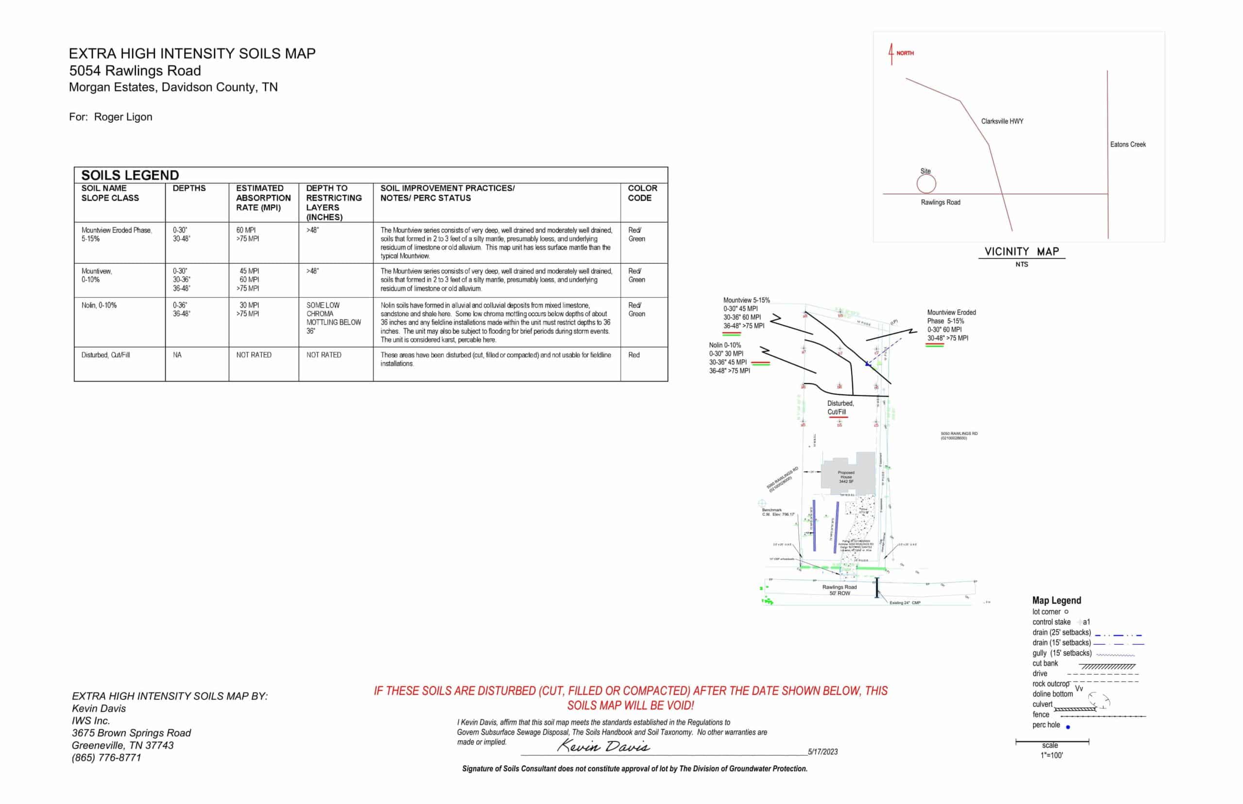
An Extra High Intensity Soils Map is a more detailed map than a High Intensity Soils Map. Typically, these maps are needed for approval of an alternative septic system like a low pressure pipe (LPP) septic system or drip irrigation system. These maps will detail the loading rates within the soil profile. LPP systems are designed on the top 30 inches of soil, and drip systems are designed on the most restrictive horizon in the upper 20 inches. TDEC will require an Extra High Intensity Soils Map if the site meets any one of these conditions:
- Site contains some usable soil area but not enough for a conventional septic system based on the High Intensity Soils Map.
- After initial site visit from TDEC, TDEC requests further information to determine suitability of the site for septic permit approval based on soil disturbance from cutting or filling.
- TDEC will request to determine if there is any alternative septic system that can be approved for the site.
An Extra High Intensity Soil Map is a First Order survey as defined in the Soil Survey Manual. Soil map units are mostly soil series that are located in TDEC’s Regulations to Govern Subsurface Sewage Disposal Systems. These maps will be on a map scale of 1 inch equals 50 feet. To complete this map, we will need the following:
- All lot corners marked and numbered or grid staked.
- A numbered line stake shall be visible from any point on the lot.
- Heavy vegetation removed if it interferes with soil mapping. Cleared areas to be mowed shall be maintained until soil map is completed.
- Wooded lines cleared for line of sight on lot lines and shall be maintained until soil map is completed.
- House site or structure to be marked and or flagged.
- Survey or Tennessee Property Map
- Soil Pits may be required to complete this task
If the site will only support a drip irrigation septic system, then we will complete soil pit descriptions for TDEC approval. Our deliverable will show the soil series that are located on the lot in accordance with TDEC’s Regulations to Govern Subsurface Sewage Disposal and the Soils Handbook. This map does not guarantee approval of the TDEC septic permit.

Contact Us
Need one of our services?
From site planning to construction, IWS, Inc. is available and capable for all your development needs.