- 7740 Lonesome Pine Trail Greeneville TN 37743
- iwsonsite@gmail.com
- 423-429-7778
High-Intensity Soil Map
High-Intensity Soil Map
A High Intensity Soils Map is the most popular service that we offer. TDEC will require a High Intensity Soils Map if the site meets any one of these conditions:
- Site is going to be subdivided in less than 5 acre tracts
- After initial site visit from TDEC, TDEC requests further information to determine suitability of the site for septic permit approval. Typically, the owner will receive a letter from TDEC requesting a High Intensity Soil Map of the site.
- An unapproved subdivision, in some cases, TDEC will require a High Intensity Soil Map to determine suitability. This is typically older subdivisions that had plat approval through the county but did not have approval through TDEC.
- TDEC could require a High Intensity Soils Map at any time no matter if the site is under an acre or over 5 acres. If a site has been filled or graded, then TDEC may require this soil map to determine today’s suitability.
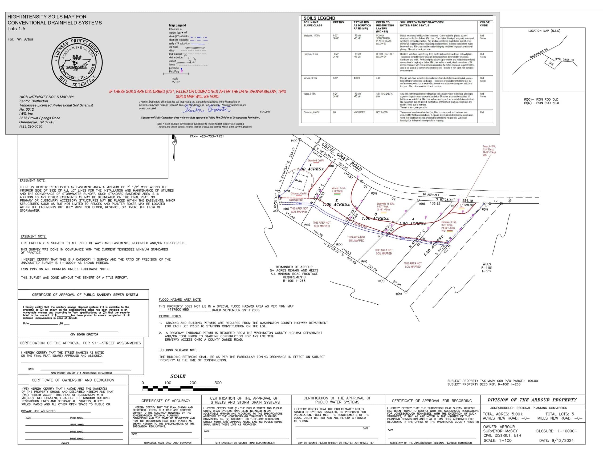
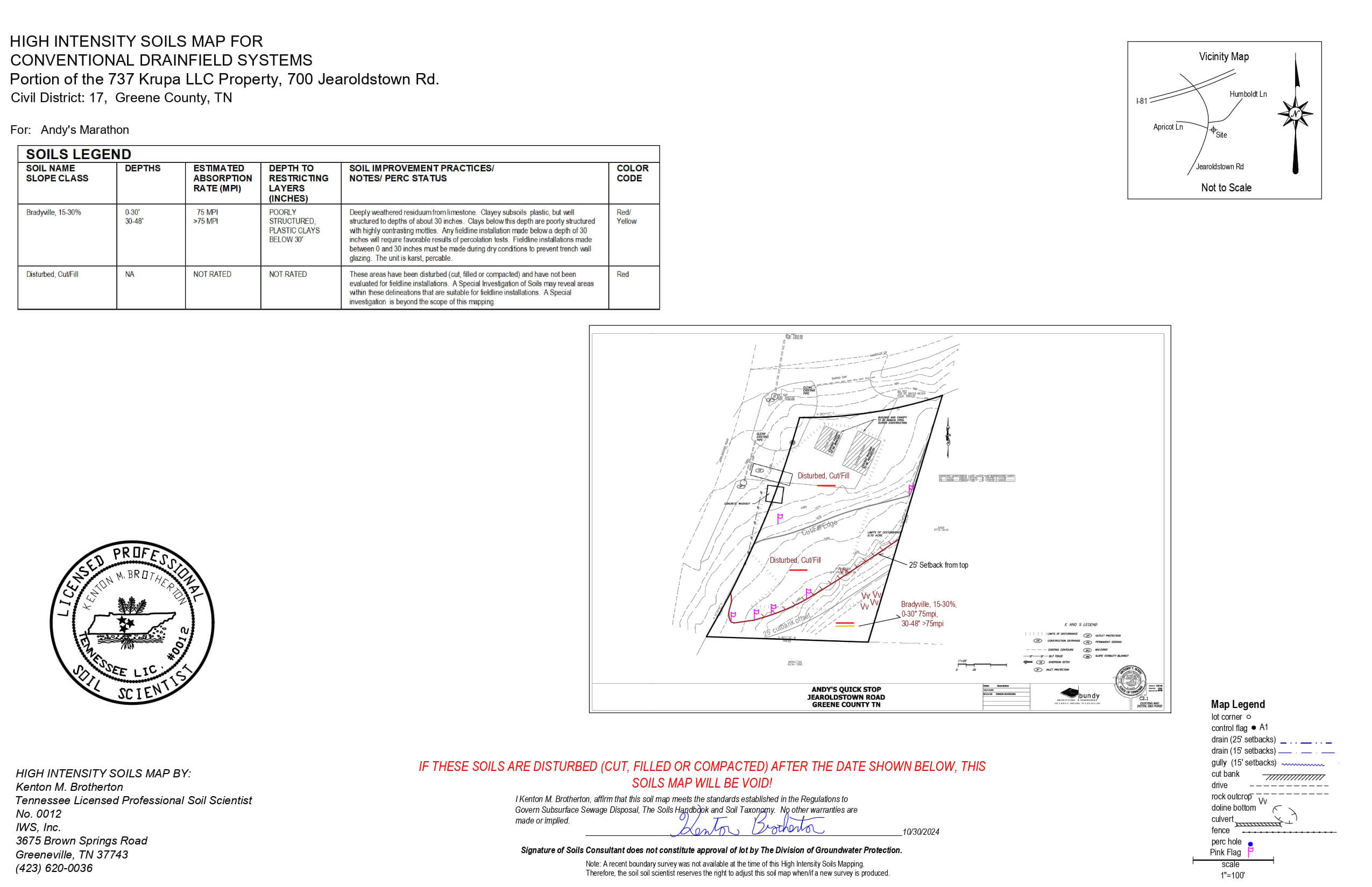
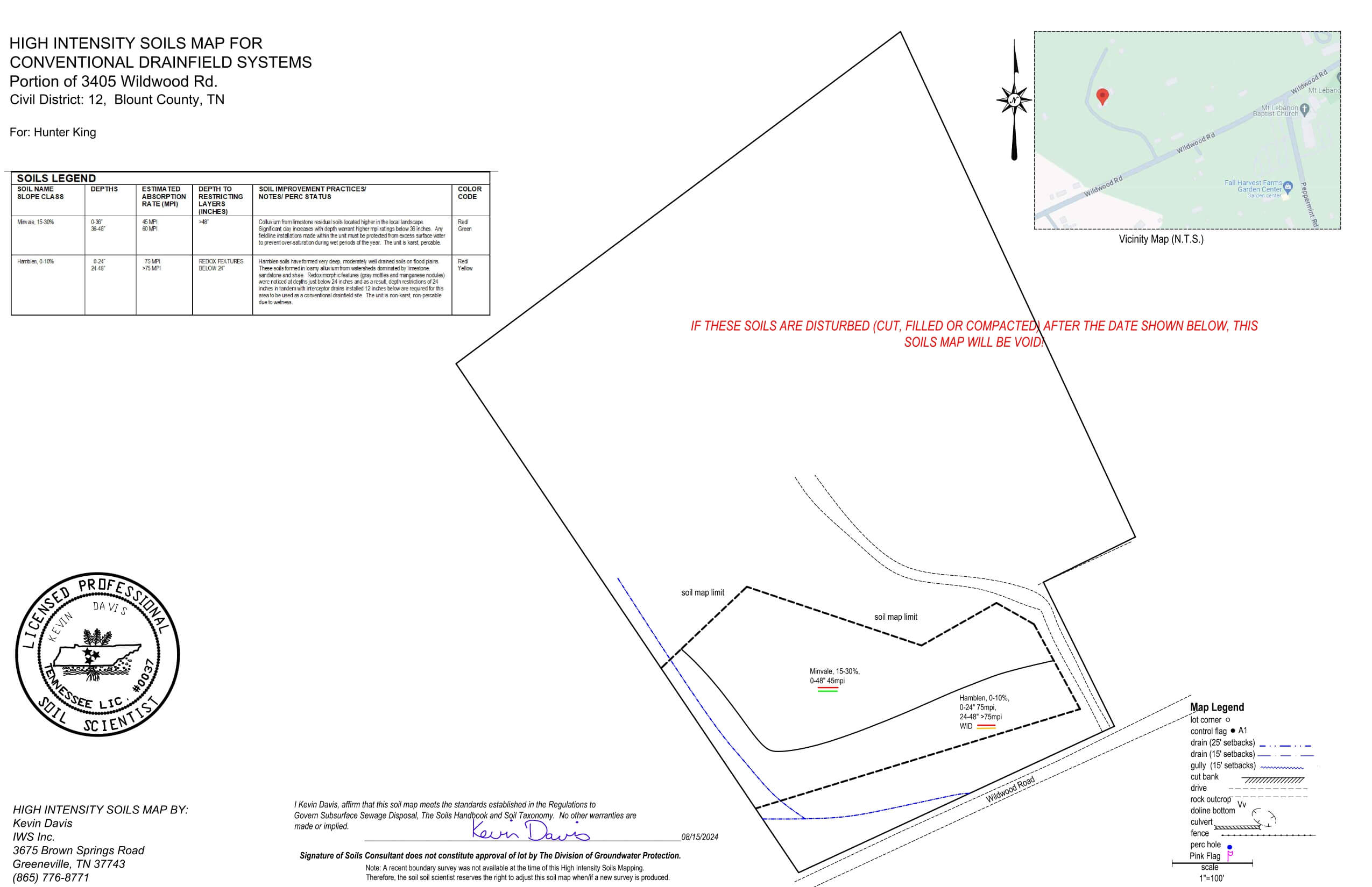
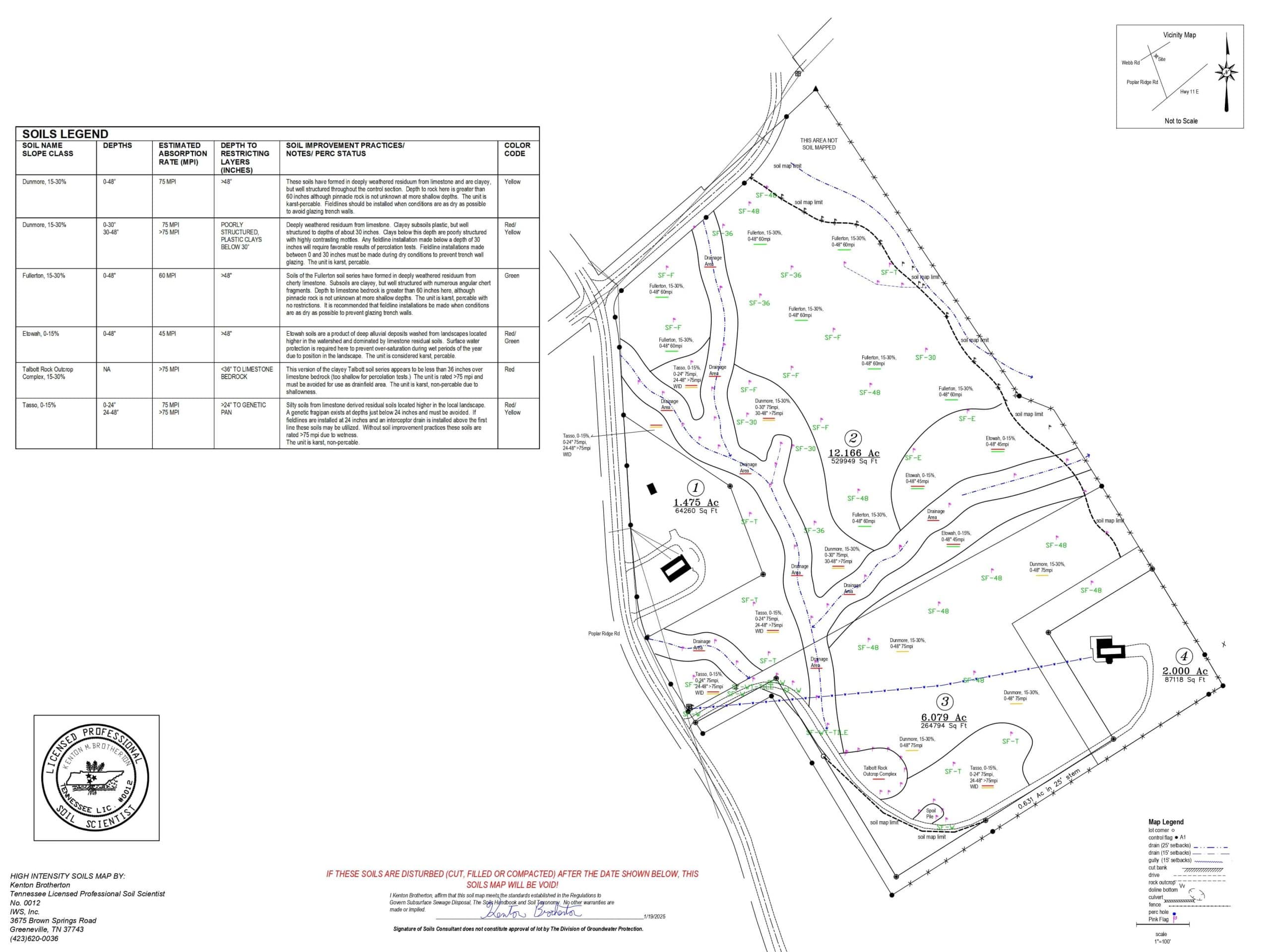
A High Intensity Soil Map is a First Order survey as defined in the Soil Survey Manual. These surveys are made for very intensive land use that requires very detailed soils information that is very precise in respect to soils and their variability on a particular landscape. Soil map units are mostly soil series that are located in TDEC’s Regulations to Govern Subsurface Sewage Disposal Systems. These maps will be on a map scale of 1 inch equals 100 feet. To complete this map, we will need the following:
- All lot corners marked and numbered or grid staked.
- A numbered line stake shall be visible from any point on the lot.
- Heavy vegetation removed if it interferes with soil mapping. Cleared areas to be mowed shall be maintained until soil map is completed.
- Wooded lines cleared for line of sight on lot lines and shall be maintained until soil map is completed.
- House site or structure to be marked and or flagged.
- Survey or Tennessee Property Map
- Soil Pits may be required to complete this task
Our deliverable will show the soil series that are located on the lot in accordance with TDEC’s Regulations to Govern Subsurface Sewage Disposal and the Soils Handbook. This map does not guarantee approval of the TDEC septic permit.
Contact Us
Need one of our services?
From site planning to construction, IWS, Inc. is available and capable for all your development needs.